
Mô tả
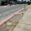
Let’s say I’m biking along Otis Dr, just past Broadway and I plan to cross the bridge because I have things to do at Bayfarm. I’ll pass multiple 25 MPH speed limit signs, school crossing signs, and street signs. I bike up Otis till I’m at High St and see an additional hospital sign. Nothing is really telling me that there is a specific bike trail coming up for the bridge. There is no bike route sign anywhere before the bridge till it’s too late. Just after the blocked off Post there is a yellow sign warning drivers of a signal ahead. Nothing about the bridge or anything else for bikers so far, except for this tiny, nearly nondescript bike sign pointing right, and pedestrians on the left. The bike sign looks like it’s going to the residential area or park nearby, but that is not the bridge. So, what is a biker left to do, but bike along the street, like they have been doing all this time? But once near the bridge it becomes obvious it is too dangerous really, so the guarded pedestrian area is the next best thing. Is there a bridge bike path? Who knows? The signs say nothing.
cũng đã hỏi...
Đáp. Near-miss – I was riding a bicycle


6 Bình luậns
Alameda, CA (Chính thức đã xác nhận)
Một người dùng SeeClickFix nặc danh (Người dùng đã đăng ký)
Một người dùng SeeClickFix nặc danh (Người dùng đã đăng ký)
Transportation Planning (Chính thức đã xác nhận)
Alameda, CA (Chính thức đã xác nhận)
Được thừa nhận Transportation Planning-Wheeler (Chính thức đã xác nhận)